
 |
| @¡Kitayama West Course (from Ninose to Kiyotaki, 19.3km) |
| @From Ninose to Kyomi toge Pass (from Board Number 47 to Number 68) |
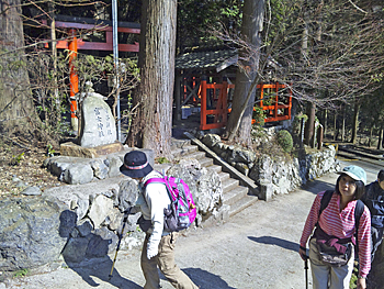 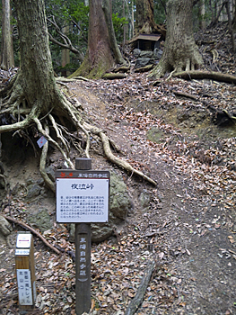 |
| Left: Moritani-jinjya Shrine / Fuji- jinjya Shrine (Ninose), Right: Yonaki-toge Pass (former trail course goes to Oiwa and new course goes to Mt. Mukai-yama from the pass.) |
|
From Ninose Station, go down narrow stairs and go upstream along Kurama-gawa River to Board No. 47 beside the bridge. When you move to Ninose by Eiden train, you do not see Board No. 46 because it is placed on the opposite side of the bridge on Kurama-kaido Road. Up side of the rail crossing, there is Moritani-jinjya Shrine / Fuji- jinjya Shrine. If you take the right path at the front of the shrine, you can go up to Mt. Kibune-yama through Ninose-yuri. The Kyoto Trail Course goes up straight. The course is the same as Tokai-shizen-hodo (nature trail). Keep going on the quiet zigzag pass road for about 30 minutes, and you will reach Yonaki-toge Pass of Board No. 50. If you take the former course, you go down to Kuriyasha-dani from the pass and take Kuriyasha-rindo (forest road) and Kumogahata-kaido (road) to Sanko-bashi Bridge (Board No. 55). It is about 1.2 km. The upper part is a good course among quiet cedar forest, but the lower part is a little bid in a bad condition. Walk on Kumogahata-kaido (road) with attention because the road is narrow. The former course will be unified to the new Kyoto Trail Course in the near future. |
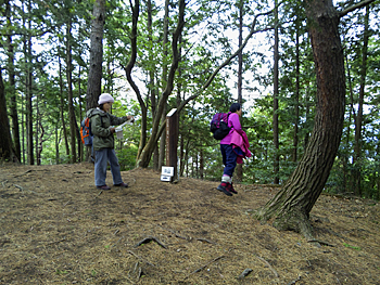 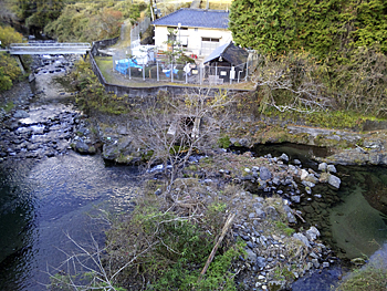 |
| Left: Top of Mt. Mukai-yama, Right: Kurama-gawa River (right) which merges into Kamo-gawa River |
|
The new course goes to Sanko-bashi Bridge from Yonaki-toge Pass through Mt. Mukai-yama. Go back a little from Board No. 50 to No. 50-1 and get into the mountain path heading to the south. Soon the path becomes a nice promenade among trees. You will come to the fork point with the path which goes to the right (Board No. 51-1). But, keep going straight. The top of Mt. Mukai-yama (Board No. 51-3) is a nice place with fallen pine leaves. Only the southern side is open, but entire city of Kyoto can be viewed. On a clear weather day, we can also see Mt. Jubu-sen, Mt. Ikoma-yama, etc. far in the distance. As the downward slope from the peak is steep, go down with full attention when the path is wet by rain and snow. The path becomes a gentle ridge way. From Board No. 52-1 beside benches, the path becomes the Kyoto City Hokubu Clean Center Nature Trail. All paths which branch to the left lead you down to the Kyoto City Hokubu Clean Center. After seeing the bridge of the irrigation ditch of Rakuhoku Power Station of the Kansai Electric Power in the right downward and passing over the small hill, you will find Board No. 54-1. At Board No. 54-2, the path merges with the patrol road of the power plant. Board No. 54-4 is placed beside the bridge of the entrance of the power plant. The path merges with the old trail course on Kumogahata-kaido Road (Oiwa-kaido Road) which is running just up side. |
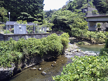 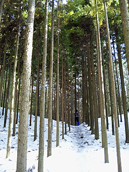 |
| Left: Around Sanko-bashi Bridge (pass by the front of the Rakuhoku Power Plant to Kumogahata-kaido Road), Right: Kotoge Pass among cedar trees |
|
Go up the stairs at Board No. 56 and turn to the left at Board No. 57 behind the private house, and you will see vegetable fields. At the junction of three paths (at Board No. 58), turn to the right. This path is a historic ancient path since Heian era. Until the current Kumogahata-kaido (Oiwa-kaido ) Road was opened, this was the approach to Iwaya-yama Shimyo-in Temple. At the place where Trail Board No. 59 and the course guide plate for the Kyoto Trail are placed, cross the valley. Take the left path at the fork of Nusutto-dani Valley. Cross the two log bridges with full attention. Go up slowly the steep slope to Ko-toge Pass which is the approach to Himuro village. If you take the mountain path which goes to the right at the fork of Ko-toge Pass, you will arrive at the top of Mt. Jyusangoku-yama through Manjyu-toge Pass (it takes about 40 min. from Ko-toge to the top of Mt. Jyusangoku-yama.) Go down through a forested site to the T-junction and turn to the left. You will get into the village. |
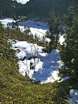 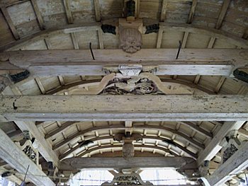 |
| Left: Remained site of Himuro (former ice chamber), Right: Carved Kaerumata, frog-leg struts (worship hall of Himuro-jinjya Shrine) |
|
Himuro is a quiet village. Head to the west on the path between rice fields from Board No. 65 where the jizo-son is enshrined. Unhook the wire for prevention of entrance of animals and pass through the fence. There is a stone marker of officially-designated historical site and near it there are three holes of old Himuro. Hook the wire after seeing the Himuro. Please show your consideration to the residents by asking permission, etc. as it is a private land. Go back to Board No. 65 and go to the south on the paved road. You will find Himuro-jinjya Shrine on your left side. The warship hall, which you see ahead through old shrine gate, was donated by Tohukumon-in and has been registered as a Cultural Property by the Kyoto Prefectural Government. It has unusual style with both of Kara-hafu gable and Chidori-hafu gable. Pass by Board No.66 which shows the fork road to Kamigamo and go up the paved road. The junction of three roads with a traffic road (Board No. 67-1) is called gHimuro-wakareh. From here, the trail course is divided into two. The left is Kyomi-toge Pass. The ancient people praised the view of Kyoto from the pass saying that they could have a sweeping view of Kyoto in one glance. Go down the pass, and go up the right steep mountain slope from the fork point of Board No. 68 with the course guide board of the Kyoto Trail Course. But it is not allowed to get into this mountain path during pine mushroom season from September 25 to November 10. During the above period you should go down straight on the paved road along Nagasaka-goe Path to Senzoku through Dono-niwa; there is a teahouse. At Senzoku the path merges with Tokai Shizen Hodo; the Tokai Nature Trail. Take a detour to Kaminomizu-toge Pass along the headstream of Kamiya-gawa River. Until the opening of Shuzan-kaido Road in Taisho era, Nagasaka-goe Path was the entrance to Kyoto from Tanba. This place was battle fields in many historic wars in Gempei period (late 11th century-late 12th century) and the Period of North and South Dynasties (1336-92), and also in the Onin War (1467-1477). sApproximate time requiredt Ninose Station of Eiden (10min.© š10min.) Fuji-jinjya Shrine (No.49) (15min.© š20min.) Yonaki-toge Pass (No.50) (10min.© š15min.) Top of Mt. Mukai-yama (No.51-3) (20min.© š15min.) Fork place to Clean Center (No.52-2) (55min.© š45min.) Sanko-bash Bridge (No.56) (25min.© š35min.) Old hut at Nusutto-dani (No.60 ) (20min.© š25min.) Ko-toge Pass (No.62) (10min.© š10min.) Himuro (No.65) (35min.© š35min.) Himuro-wakare fork place (No.67-1) (15min.© š15min.) Fork place on Kyomi-toge Pass (No.68) Fork place on Kyomi-toge Pass (No.68) š30min.) Senzoku Ninose Station of Eiden (3hours and 35min.© š3hours and 45min.) Fork place on Kyomi-toge Pass (No.68) |
| š Eastern Kitayama Course (Trail Board Number 24 to 46 of Kitayama Course) |
| š Western Kitayama Course (Trail Board Number 68 to 94 of Kitayama Course) |
| š High points |
| š Back to the Top of this Page |
| © Kyoto Trail Guide Association |